OWN THE FUTURE · SEASON 3 · RAPID URBANIZATION
What is infrastructure? Counted in Swedish kilometres
Infrastructure is what we rarely think about until it stops working: roads, tracks, pipes and networks. We explain what the road and rail networks are made of, counted in kilometres, and what an urban area is according to the statistics.
Published 10 Sep 2026 · About 8 minutes to read
You drive on it. You cycle on it. You complain about it when it is broken. But ask someone what infrastructure actually is, in figures, and most people go quiet.
This article gives the figures. No vision of the cities of the future, just what already exists, counted by the agencies responsible for it.
The road network is just over six times as long as the railway track
Start with what you drive on. The state road network in Sweden covers about 98,500 kilometres of road.2, 3 Of that, about 2,000 kilometres is motorway, a small part of the whole.2 Roughly 80% of the length of the road network is paved, and the rest has a gravel surface.2, 3
Along the roads there are 17,000 road bridges and 69 bridges that can open to let boats through.2
The railway is much shorter. Sweden's railway network consists of about 15,600 kilometres of track, of which the Swedish Transport Administration manages about 14,200 kilometres.1, 2 Around 80% of the railway is electrified.1, 2 The network also includes a large number of tunnels, bridges and level crossings.1
And then the part people forget: the Swedish Transport Administration also maintains about 3,900 kilometres of footpaths and cycle paths, roughly 5% of the length of the paved road network.3
One thing to notice: two of the Swedish Transport Administration's own documents give the same figure with different precision.2, 3 One says that about 80,000 of the 98,500 kilometres are paved, the other says about 80%.2, 3 The two are consistent but not worded identically, and this article uses the percentage, because it comes from the more formal of the two sources.2
What an urban area actually is, according to the statistics
Now to the word urbanisation, which is the theme of this area. It needs an exact definition to be of any use, and Sweden has one.
A statistical urban area (tätort) is a continuous built-up area with at least 200 inhabitants.4, 5 It is not the same as a municipality or any other administrative boundary, and it is not the same as the urban area concept used by the mapping agency Lantmäteriet, which is defined differently.5, 10
Since 2015 the definition has been built in several steps.5, 6 First a core is found, where the houses may be at most 150 metres apart.5, 6 Then cores are linked with other buildings via the road network. The distance allowed increases step by step with how many people live and work in the parts, from 200 metres up to at most 500 metres.5, 6 Sports grounds and cemeteries can be counted as part of an urban area.5, 6 Water without a bridge works as a barrier and divides it.5, 6
Sweden has more than 2,000 such urban areas, and over 9 million people, 88% of the population, live in one.4, 5 Exactly 9,265,976 people, according to the 2023 statistics.4, 5
In 2023 the statistical urban area of Stockholm had more than 1.65 million inhabitants and stretched across twelve municipalities, while the municipality of Stockholm had just under a million.5, 9, 10 The municipality of Uppsala has 31 urban areas, the most in the country, while thirteen municipalities have only one.5, 8 Sweden has ten urban areas with more than 100,000 inhabitants, all in the southern half of the country, and Uppsala is the furthest north of them.5, 10
Sweden's most and least urban places
Here the country varies more than you might think. The highest urbanisation rate is in Stockholm County, at 97%.4, 5, 8 The lowest is in Gotland County, at 65%.4, 5, 8
The municipality of Berg in Jämtland has the country's lowest urbanisation rate, 35%.5, 8 Arjeplog is Sweden's most sparsely populated municipality, with 0.2 inhabitants per square kilometre, yet 62% of its population lives in its only urban area.5, 8, 9 So sparsely populated and urban are not opposites: a municipality can be both, if almost everyone who lives there lives on the same small spot.5
of Sweden's population lives in an urban area, a continuous built-up area with at least 200 inhabitants, 2023.
SOURCE: Statistics SwedenHow Sweden became a country of urban areas
The shift is more recent than you might think, and it went fast when it came.
200 years ago, 90% of Sweden's 2.3 million inhabitants at the time lived in the countryside.5, 7 By the early 1930s it was even between urban areas and the countryside, roughly half and half.5, 7
The shift was fastest in the 1940s and 1950s: the population in urban areas grew by around a million people, while the population outside urban areas fell by 400,000, over the same decades.5, 7
The whole time series, in number of people living in urban areas: 229,479 in 1800, 1,448,847 in 1900, 5,451,156 in 1960, 9,265,976 in 2023.7 And outside urban areas, in the same years: 2,117,824, 3,687,594, 2,046,811, 1,285,731.7
Read the two series side by side. One has grown forty times since 1800.7 The other has shrunk to less than two thirds.7 The same country, the same period, and opposite curves.
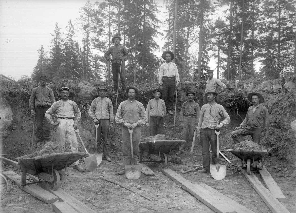
An urban area can also stop being one. It is removed from the register if its population falls below 200 inhabitants, or if it grows together with another urban area and becomes part of it instead.4, 5 The statistics on the number and extent of urban areas are based on data from 2023 and are updated less often than the population statistics, which are taken from the population register every year.5
What to take away
The state road network is about 98,500 kilometres, of which around 2,000 kilometres is motorway, and the railway is 15,600 kilometres of track.2 A statistical urban area is a continuous built-up area with at least 200 inhabitants, and 9,265,976 people, 88% of the population, lived in one in 2023, against roughly half in the early 1930s.4, 5, 7 The force lies in inertia: networks are built once and used for decades, and the move into urban areas took two centuries, with the 1940s and 1950s as the fastest phase.5, 7 Follow three recurring publications: the Swedish Transport Administration's annual report with the lengths of the networks, Statistics Sweden's urban area statistics, and Statistics Sweden's population statistics from the population register, which are updated every year.2, 4, 5
The next episode is S3:E2 Construction, about the road from detailed development plan to moving in, and how long it takes.
Education, not advice.
The fund
Behind the library stands a fund.
Own The Future is published by AIX. The library is the knowledge; AIX Dynamic is the tool, a systematic securities fund (UCITS) that follows the trend and steps aside when risk rises.
This is marketing. Fund units can both rise and fall in value. Read the key information document (KID) and the prospectus before you invest; you will find them on the fund's page at Avanza.
34 UNITHOLDERS · AS OF 15 SEP 2026The future in your inbox.
The most important things from each area, without the noise and without the hype.
Sources
- Swedish Transport Administration (Trafikverket), Sveriges järnvägsnät (Sweden's railway network), page last updated 10 Sep 2026.
- Swedish Transport Administration (Trafikverket), Trafikverkets årsredovisning 2024 (The Swedish Transport Administration's annual report 2024), Trafikverket publication 2025:006, Borlänge 2025, page 17. The state road network about 98,500 kilometres, of which about 2,000 kilometres motorway and about 80% paved road, 17,000 road bridges and 69 opening bridges; the railway network about 15,600 track kilometres, of which the Swedish Transport Administration manages about 14,200, and over 80% electrified. Document checked 11 Sep 2026.
- Swedish Transport Administration (Trafikverket), Vidmakthållande av transportinfrastrukturen, underlagsrapport till Inriktningsunderlag för 2026 till 2037 (Maintaining the transport infrastructure, background report to the planning basis for 2026 to 2037), Trafikverket publication 2024:009, Borlänge 2024. Page 12: about 98,500 kilometres of state road, of which about 80,000 kilometres paved. Page 17: about 3,900 kilometres of footpaths and cycle paths, about 5% of the length of the paved road network. Page 37: about 14,200 track kilometres, of which 12,000 electrified. Document checked 11 Sep 2026.
- Statistics Sweden (SCB), Ökad andel boende i tätorter och småorter 2023 (Larger share living in urban areas and small settlements 2023), statistical news release with data for 2023.
- Statistics Sweden (SCB), Tätorter i Sverige, Sverige i siffror (Urban areas in Sweden, Sweden in figures), updated 28 Nov 2024. Supports the urban area definition and the steps since 2015, the core's 150 metres, the step by step increasing distances via the road network up to 500 metres, sports grounds and cemeteries, and water without a bridge as a barrier, Lantmäteriet's different concept, more than 2,000 urban areas with over 9 million residents and 88%, the Stockholm urban area across twelve municipalities against the municipality's just under a million, the 31 urban areas in the municipality of Uppsala, the thirteen municipalities with a single urban area, the ten urban areas over 100,000 inhabitants with Uppsala furthest north, the urbanisation rate by county, the municipality of Berg at 35%, Arjeplog's 0.2 inhabitants per square kilometre and 62% in the municipality's only urban area, the 90% in the countryside 200 years ago out of 2.3 million inhabitants, the balance in the early 1930s, urbanisation at its fastest in the 1940s and 1950s, and that the urban area statistics are updated less often than the population statistics.
- Statistics Sweden (SCB), Kvalitetsdeklaration, Tätorter, referensår 2023 (Quality declaration, urban areas, reference year 2023), version 2, 25 Mar 2026. Supports the full definition in seven steps, the core with at most 150 metres as the crow flies, the step by step maximum distances of 200, 390 and 500 metres via the road network, sports grounds and cemeteries, water without a bridge as a barrier, the minimum of 200 inhabitants, the number of objects, 2,017, for the reference year 2023, and that the 2015 review is the definition that applies.
- Statistics Sweden's statistical database (SCB Statistikdatabasen), Befolkningsutvecklingen i Sverige fördelat på urban och rural befolkning, vart femte år 1800 till 2023 (Population trends in Sweden split into urban and rural population, every fifth year 1800 to 2023), table HistBefTatort, 28 Nov 2024. Supports the whole time series in and outside urban areas, the figures for 1800, 1900, 1960 and 2023, the shares per year and so the balance in the early 1930s.
- Statistics Sweden's statistical database (SCB Statistikdatabasen), Antal tätorter och tätortsgrad (andel folkmängd i tätort) efter region, vart femte år 2005 till 2023 (Number of urban areas and urbanisation rate, share of population in urban areas, by region, every fifth year 2005 to 2023), table TatortGrad, 28 Nov 2024. Supports 2,017 urban areas and 88% for the country, Stockholm County 97 and Gotland County 65, the municipality of Berg as the lowest in the country at 35%, the municipality of Uppsala with the most urban areas (31), and that exactly 13 municipalities have a single urban area, among them Arjeplog with 62%.
- Statistics Sweden's statistical database (SCB Statistikdatabasen), Folkmängd och landareal i och utanför tätorter efter region, vart femte år 2005 till 2023 (Population and land area in and outside urban areas by region, every fifth year 2005 to 2023), table BefLandInvKvmTO, 28 Nov 2024. Supports Arjeplog's population density of 0.2 inhabitants per square kilometre as the lowest of the country's 290 municipalities, and the population of the municipality of Stockholm, 988,943, just under a million.
- Statistics Sweden's statistical database (SCB Statistikdatabasen), Folkmängd och landareal i tätorter per tätort, vart femte år 1960 till 2023 (Population and land area per urban area, every fifth year 1960 to 2023), table LandarealTatortN, 28 Nov 2024. Supports the Stockholm urban area's 1,652,895 inhabitants in 2023, that exactly ten urban areas have more than 100,000 inhabitants and that Uppsala is the furthest north of them, that the table holds 2,017 urban areas with a value for 2023, and, in the table's note, that Lantmäteriet's urban areas are drawn for map purposes and do not match Statistics Sweden's.
- Swedish Railway Museum (Järnvägsmuseet), Rallare i en skärning (Railway navvies in a cutting), collection record JvmKADA00023 on DigitaltMuseum. Supports the photograph, the photographer Anders Wilhelm Ljunggren, the year 1898, the line from Sala to Gysinge and the licence Public domain mark.
Links retrieved 4 Sep 2026. Extended on 13 Sep 2026 with Statistics Sweden's overview Tätorter i Sverige (Urban areas in Sweden), the quality declaration for the urban area statistics, the statistical database's four tables behind the time series, the urbanisation rate, the population density and the individual urban areas, and the Swedish Railway Museum's collection record for the photograph. Statistics Sweden's news release gives 90% living in urban areas and small settlements together, while the article's 88% refers to urban areas only. Statistics Sweden's own text puts the rise in urban areas at around a million and the fall outside urban areas at 400,000 for the 1940s and 1950s together, while the statistical database's table gives plus 1,869,840 and minus 743,305 for the whole twenty-year period, and plus 1,077,213 and minus 406,816 for the 1940s alone. The article follows Statistics Sweden's text.